ESASky User Forum / Whiteboard
Welcome to the ESASky user forum! The aim of this forum is to have a place to collect feature requests from users, allow conversations between users and gauge the Astronomy community's priorities related to the ESASky application. We welcome requests for the ESASky, its documentation, its ways of interacting with the community, and any functionality which you think would be widely useful to the Astronomy community.
Please suggest and vote on feature requests below. Before adding a new suggestion, use the search function to see if the idea has already been posted. Please include links to relevant repositories and existing issues in the description of the feature request. Also consider including links to code or images demonstrating the requested functionality.
You can also use this forum to report bugs or request small improvements to existing functionality.
Other places to get help and communicate with the ESASky team are:
- @ESAESDC on Twitter
- The ESASky newsletter
- The team's info email address (esaskyinfo at sciops.esa.int)
- The ESASky helpdesk (requires registration)
The ESASky Project is dedicated to maintaining a positive, inclusive, successful, and growing community. Please observe the usual basic internet citizen rules before posting to this forum.

 Allow upload DS9 format regions
During the commissioning of the MEGARA instrument at GTC, ESAsky was used. It was very useful, but it would be even more with the capability of uploading DS9 region files, mainly used to represent instruments focal planes.
http://ds9.si.edu/doc/ref/region.html
Other formats as VO would be nice, but ds9 is still broadly used in the astronomical community

 Vizier catalogue overlay (for Herschel Galactic Plane data)
The Hi-Gal Consortium public database provides an incremental access to compact source catalogues through Vizier (http://vizier.u-strasbg.fr/viz-bin/VizieR-3?-source=J/A%2bA/591/A149&-out.max=50&-out.form=HTML%20Table&-out.add=_r&-out.add=_RAJ,_DEJ&-sort=_r&-oc.form=sexa) as well as through the Vialactea Project web-interface (http://tools.asdc.asi.it/HiGAL.jsp).
It would be a useful scientific tool and a great added value if EsaSky can provide a capability to overlay catalogues on background intensity maps. The interwoven structure of filaments Herschel resolves in large-scale images are well correlated with locations of starless and star forming cores. An overlay functionality could guide scientist to identify 'interesting' areas for follow-up studies. Filtering of overlaid sources based on catalogued observables (colours, photometry, size, shape parameters etc.) could further enhance the science use of such functionality.

 Q1 Euclid Projection Issues
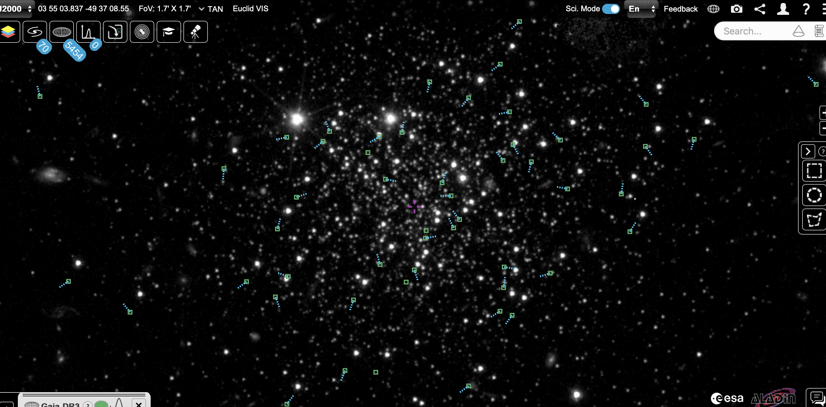
There seems to be an issue with the projection in Euclid Q1 data.
An example can be seen here, where the diffraction spikes of a star show corners/bends. This is still present further down in the next extended galaxy
https://sky.esa.int/esasky/?target=57.29489296904921%20-48.84013170362207&hips=Euclid+VIS&fov=0.020563664376747375&projection=SIN&cooframe=J2000&sci=true&lang=en
https://sky.esa.int/esasky/?target=57.29399866905784%20-48.855618663751216&hips=Euclid+VIS&fov=0.02553562820006663&projection=SIN&cooframe=J2000&sci=true&lang=en
This is also present in the NIR bands and the "euclidised" ugriz.

 Are the Deep Field Q1 Tiles for the Deep Field Mosaics the maximum resolution images from the telescope?
Hi,
Is the resolution of the individual tiles that compose the 3 Deep Field Q1 mosaics the very maximum resolution captured by the telescope? (I'm referring to the individual tiles accessed via URLS in the script Download_Q1_Color_Tiles.sh cited in the notes for the Q1 Deep Fields in the ESASky web app.)
I had assumed they were, except I located the J041110.98-481939.3 gravitationally lensing cluster in tile EWS-Q1-EDFS-MosaicR4-290K230K_05_05.RGB.png from that script and compared it to the officially released 70x zoom image of the cluster available here (5000x2813 pixels) and it seems to me that the 70x zoom is a bit sharper than the tile. So is the telescope's captured full resolution image of the Deep Field South mosaic actually larger than 290K x 230K, and if so, what are the dimensions of the full resolution of that mosaic?

 Same tiles download shell script link for all 3 deep fields
Hi,
For the recently released deep field mosaics, the same tiles download shell script is given (Download_Q1_Color_Tiles.sh). I think it's the one for the Fornax deep field tiles. Could you correct the tile download shell links for the North and South deep fields?

 toggle layer of constellations to allow sense of scale
to give directional sense to humans, locate the device, then make a virtual zoom from the viewers perspective of the constellations as if they were looking in the direction, from their location, and then zoom through the layer of constellations to the astrological event that they have chosen to view.

 CORS
CORS
Hello folks,
This is my first post here - a doubt.
I tried this call:
postMessage({event: 'changeHipsWithParams', content: {'hips': {'name': 'Gaia DR3 colour flux map', 'id': 'G001', 'url': 'http://foo-bar-baz/plugins/esaSky/dr3_RGBHiPS', 'cooframe': 'J2000', 'maxnorder': '4', 'imgformat': 'png'}}}, '*');
The HiPS file was not loaded and Chrome showed me this instead:
Access to fetch at 'https://cdn.skies.esac.esa.int/DSSColor//Moc.fits' from origin 'https://sky.esa.int' has been blocked by CORS policy: No 'Access-Control-Allow-Origin' header is present on the requested resource.
Do it check https://cdn.skies.esac.esa.int/DSSColor because my HiPS dataproduct_subtype parameter value is "color"?
I know it's not related, but I checked the other parameters anyway, like maxnorder.
Do you have a suggestion to bypass this CORS issue?
Thanks in advance,
Bruno

 Search does not work when using esasky from my phone
Hi,
I have been trying to search for some objects using Google chrome from my phone and search does not work. I upload a video so you can see the problem.
ScreenRecording_01-17-2025 11-51-49_1.MOVCheers,
Nuria
Customer support service by UserEcho


