Tus comentarios
Dear David,
The ESASky External Data Centre's feature is linking to the MAST Table Access Protocol (TAP) service. Therefore, to include TGLC light curve data, ideally we would want this data to be included in the MAST TAP, otherwise ESASky will be giving the wrong impression to users that this data is available via the MAST TAP when in fact it is not. I see in the TGLC MAST page (https://archive.stsci.edu/hlsp/tglc) that MAST provides other services to access the data. Can I suggest you send your request to MAST (https://archive.stsci.edu/contacts.html) to include the TGLC data in their TAP? Any clients that access TAPs (ESASky, TOPCAT, Aladin etc.) will then automatically be able to access the TGLC data too.
Many thanks and regards,
Deborah, on behalf of the ESASky team
Dear Patricio,
I'm glad this functionality is working for you! We'll reply to your other two questions asap.
Many thanks and I'm glad you're finding the API useful!
Best regards,
Debbie
Dear Lukasz,
Yes, unfortunately we do not currently have this functionality in ESASky, but we will add it to our backlog and try to include it very soon in ESASky.
In the meantime, you can do this in Aladin desktop (https://aladin.cds.unistra.fr/, requires java). If you open the tool, go to your location of interest, then in the left hand side open 'Others' and 'HiPS', and also 'Image' (which are all the HiPS from CDS), everything that appears green should have data available in that region.
I hope this helps.
Kind regards,
Deborah
Dear Fanfan,
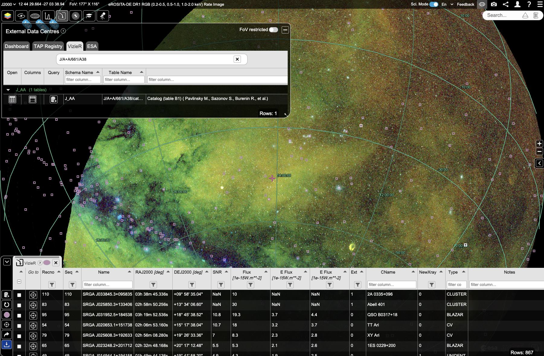
Many thanks for your suggestion, we'll add it to our list. Please also note that as soon as this catalogue is available in VizieR, it can also be loaded in ESASky by doing the following:
Select the 5th icon from the left (the External Data Centres button), then click the VizieR tab and search for the catalogue in the top field that says 'Query TAP filters'. If you untoggle the FoV restricted button you'll be able to download all sources in the catalogue (if they are below 10,000 sources, otherwise it's the first 10,000). Click on the 'Open table' button to the left of the catalogue, in the column titled 'Open'. Here's an example for the SRG/ART-XC 1st year all-sky X-ray survey:

Kind regards,
Deborah on behalf of the ESASky team
Dear Jerry L.,
The 24Kx24K resolution images on ESASky have only been provided to guide the users toward the calibrated full-resolution Euclid images available using the link to the cosmos web site ( https://www.cosmos.esa.int/web/euclid/ero-public-release ) and are not made available as such. Your previous request had already been escalated to the Euclid Mission Manager and the answer I provided reflected his answer and the rules that have been set for access to these files (this answer also reflects the answer from the Mission Manager). Not all Euclid data products can currently be downloaded publicly. We apologize for any inconvenience this may cause.
Kind regards,
Deborah on behalf of the ESASky team
Dear Nadia,
Many thanks for your suggestion. We have added it to our backlog of tickets as a very nice feature to have in ESASky!
This is exactly the kind of input we are looking for from our users, so thanks again!
Best regards,
Deborah, on behalf of the ESASky team
Servicio de atención al cliente por UserEcho

